Decision Support
EQuIS Decision Support Modules
EQuIS EnviroInsite, Geotechnical Module, Alive, and Risk3T are Decision Support products that can be added to any Professional library.

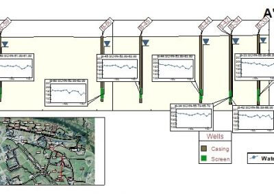
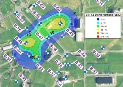
EQuIS EnviroInsite is a toolkit for the analysis and visualization of environmental data.
EnviroInsite has multiple capabilities, including creating site maps, analyzing stratigraphy, visualizing environmental data, and preparing report graphics.
EnviroInsite connects to an EQuIS database and directly accesses EQuIS data.

EQuIS Alive extends EQuIS to manage survey, ecological, biological, and taxonomy data. Alive integrates with other EQuIS applications for enhanced biological data analysis.
Clients may design and export Alive surveys for use in the field and also view survey results, species density reports, species count exceedances, and species observations.
EQuIS Alive extends EQuIS to manage survey, ecological, biological, and taxonomy data.
Risk3T for EQuIS is a risk assessment toolkit that examines environmental risk and is used by industry, government, and consultants. Risk3T makes risk assessments quick, easy and cost effective with the following modules:
Site-Specific Calculator conducts Tier 2 or Tier 3 risk assessments to determine site-specific remedial goals or Action Levels protective of human health and the environment.
Tier 1 Action Level Calculator is used by regulatory agencies, industry, and consultants to support the management of environmentally impacted sites.
Lookup Action Level Generator significantly simplifies the process of determining which screening levels are applicable to a site for complicated regulatory programs.


Solutions
Want to Learn More?
Explore EQuIS Environmental Data Management Workflows
Contact Us
125 S. Alcaniz St., Suite 2
Pensacola, FL 32502
800.649.8855
info@earthsoft.com
Subscribe to Our Mailing List
Stay informed about our upcoming events, news,
and more.


